Houzz Logo Print
moonie_57

Panama Canal Pilots...Annie, Jim_1, bob_cville...

8 years ago
last modified: 8 years ago
In another thread I saw where all 3 of you had mentioned going through the PC. One thing that really stood out was bob mentioning his guide said "the canal operating crew was probably already talking with the ships captain to pay for damage to the ship."

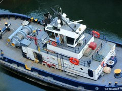
My dad was a tugboat engineer with the Pan Canal Co for 20 years. One of his jobs was to deliver PC pilots to the ships. The pilots were in complete control of the ships. Any damage caused to any ship or to the locks would be on the part of the PC company pilot. I'm wondering if they're still as heavily insured as when the U.S. had control of the PC.

With the Canal reverting to the republic of Panama I was wondering if those procedures have changed. It would be interesting if anyone had insight into how they may deal with transit policies these days.

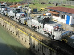
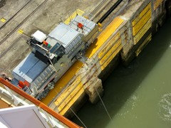
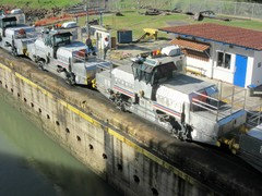
Jim, even before the big Panamax ships, large ships coming through with only inches of leeway, they often scrapped and grinded. I can never remember seeing smoke but, maybe. I would think with these huge container ships they would need more than 4 mules? The only thing I can think of is with the larger locks there is more water to help push the ships into the chambers? Interesting. Another job of my dads was to use the tug against the stern of ships to push them into the locks.

I would love to be sitting in the observation tower right now watching the ships come and go. I have literally seen hundreds of ships go through. It's an amazing sight!

Annie, how long did it take you to make the full transit in your sailboat? What year was that? Wow, you all have me reminiscing about home tonight!

Comments (59)

  • 8 years ago
    Any experienced ship commander, whether the actual Captain or an underling, is more than comfortable with pilots because they're used in most every harbor/port. And certainly in any one of significance. The pilot is responsible for the ship after assuming command.

    moonie_57 (8 NC) thanked Elmer J Fudd
  • 8 years ago
    last modified: 8 years ago
    Thanks everyone for helping me sink into an obsessive state again! :)

    Last night I got so wrapped up in my memories that I had a hard time sleeping. This morning I had to get up really early to go keep the grandkids, who are home from school because we got 10 inches of snow last week! So yeah, the memories made me feel warm and fuzzy all over. In fact, my heart was doing those little flutters. But, that lack of sleep left me in a grouchy mood. My husband is probably wishing that I would put myself in time-out, so I'm going to go take a nap! haha

    I look forward to getting back here this evening to re-read this thread and looking at the pics again. Bob, here's a pic to match one from your blog. Late 60's or early 70's

    ETA: Rob, thanks for the webcam link. I used to watch it all the time..when it would work. It's like watching paint dry, but that didn't stop me. :)

  • 8 years ago

    A different view of walking across the locks.

    moonie_57 (8 NC) thanked jim_1 (Zone 5B)
  • 8 years ago
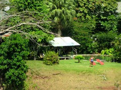
    Cool that is the third set of locks that few people visit, and not many could even name.

    moonie_57 (8 NC) thanked bob_cville
  • 8 years ago
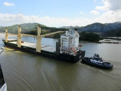
    Went partially through the Panama Canal in the mid-90s on a cruise ship. My brother in law said it was like watching paint dry, but my husband and I found it fascinating. Fact, the entrance from the Atlantic side is further west than the western entrance from the Pacific.

    moonie_57 (8 NC) thanked blubird
  • 8 years ago
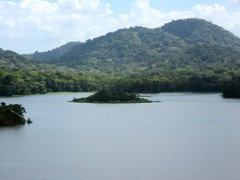
    We were on one of those excursion boats but went all the way through the Pacific locks and back again to the point where we picked up the buses to takes us back to the ship. On the return trip we were in the locks with a car carrier loaded with approximately 50,000 cars. It was enormous and there was still room in the locks for smaller vessels. I need to get my pictures off the camera LOL

    moonie_57 (8 NC) thanked chessey35
  • 8 years ago
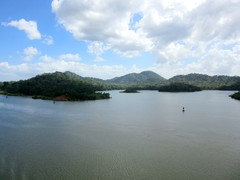
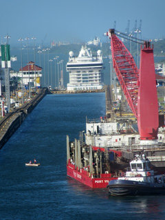
    We passed through the canal a year ago, entering on the Pacific side and exiting into the Atlantic. It was so interesting and something we've always wanted to do. Getting ready to go out, but will post a few photos later.
    moonie_57 (8 NC) thanked Rosie
  • 8 years ago
    last modified: 8 years ago
    The Path Between the Seas, written by David McCullough, is one of the best books I've ever read. It tells the origins of the interest in building a ship canal in Central America (not originally in what is now Panama), the political and economic events that were involved and caused, the first effort that failed and was abandoned at great cost, and the factors why the restart by the US was different and ultimately successful. .

    McCullough has written many outstanding books and I can recommend all of them. His face and voice are familiar to many because of his decades of appearances as a host and narrator on PBS. But that was just a side gig, his main occupation is as a writer and his books are in a class of their own.

    moonie_57 (8 NC) thanked Elmer J Fudd
  • 8 years ago
    Annie, I remember that ordeal with the Le Ponant. That must have been freaky to imagine the what-ifs! Very pretty boat... what a great experience! Do you have any photos of the San Blas islands? I have lots of molas made by the San Blas. The molas you see online for sale, supposedly by the Indians, are too current-looking.

    Elmer, I question this that you wrote in an earlier post... every harbor has pilots who come out to visiting ships using small boats and then take full command of the ship... my reasoning is because not very long ago I read a publication that said "only in the Panama Canal does a pilot take complete control". I remember it clearly and tried to strike up a conversation with DH about what that might actually mean. Darn him, he had little interest in trying to help me figure that out. We've been in enough ports to know that harbor pilots board ships and helps them navigate the waterways. I also have first hand info that in the PC, pilots do not take over the physical controls. It's driving me nuts that I can't fully understand.

    Also, thanks for the book recommendation. There is a 94 page preview that I've bookmarked. I'll read that then perhaps check it out on audible.

    bob_cville, in your photos of the control house, it shows one of the old gray control stations. It looks like maybe they still use it? Do you know? I've found all your photos (and everyones!) very interesting. Thanks for taking the time to post them! So far I have not read into your blog far enough. Been babysitting the grandkids.

    jim, more pics please! I have tons and tons of old photos so I really like seeing these later pics. I like to find something that I can maybe look back into my photos and find the same scene.

    blubird, cheesey, dawn... please post your pics!

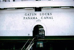
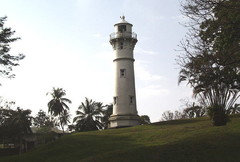
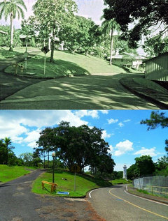
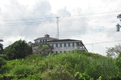
    One last thing to bug you all with.... there is a lighthouse I am trying to find out if still in existence. When coming out of the Atlantic into the Locks it would have sat up on a hill to the left. That lighthouse sat in my front yard. It has many special memories to me. Here are lighthouse photos.

    Another photo of the lighthouse... before and after all housing was torn down. The road running around the right-hand side of the lighthouse is the road to the Gatun locks. This is not my photo but one a friend sent me after going down there a few years ago. I would really like to think the lighthouse is still there. As the ship is coming into the locks this lighthouse would be to the left, up on a hill. I hope someone can remember???

  • 8 years ago
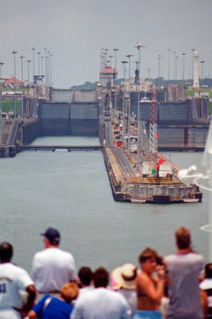
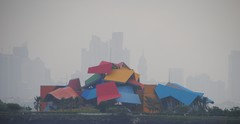
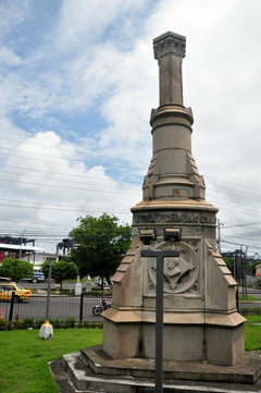
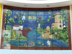
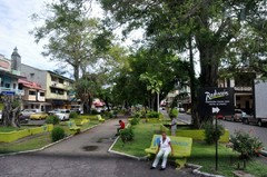
    Biomuseo in a park near Panama City.
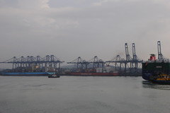
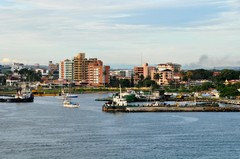
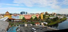
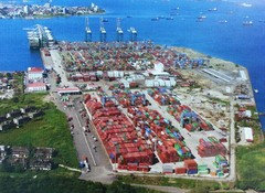
    The busy port of Balboa, Panama
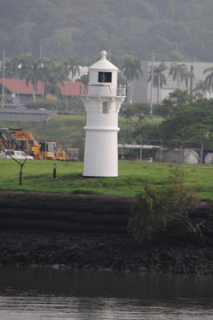
    How about this light?

    moonie_57 (8 NC) thanked jim_1 (Zone 5B)
  • 8 years ago
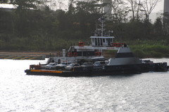
    At the north end of the canal, this ferry moves vehicles to Davis Landing.
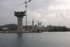
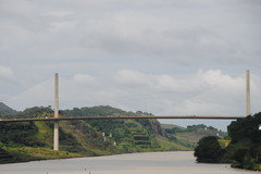
    This bridge will negate the need for the ferry (above). This photo was taken in May, 2016. I did not take a photo in November, but it has progressed rapidly.

    moonie_57 (8 NC) thanked jim_1 (Zone 5B)
  • 8 years ago
    last modified: 8 years ago
    moonie, my comment was based on an accident not too long ago in SF Bay, when a ship collided with the Bay Bridge abutment in the fog. The pilot was held liable and also sentenced to jail. It may be the practice or required that each ship's owner indemnifies the pilot org and assumes liability for third party damages. My comment should probably have been less assertive.

    moonie_57 (8 NC) thanked Elmer J Fudd
  • 8 years ago
    My father was stationed at the navy base near Colon. I hardly knew him and always looking for some kind of connection. Any pictures from the navy base down there?

    moonie_57 (8 NC) thanked lovingspring
  • 8 years ago
    I was in Colon in November but do not recall seeing a Navy Base. Previous time I was there was in 2011 and the port has increased its capacity a lot. I was somewhat in awe about its capacity.

    moonie_57 (8 NC) thanked jim_1 (Zone 5B)
  • 8 years ago

    Jim, I have to ask about the bridge... where exactly is it? Even back in the 80's there was talk about building a bridge and removing the old 1 way vehicular bridge at the locks in Gatun. Could that be the bridge? Is it before the locks or already into Gatun lake?

  • 8 years ago
    Loving spring, that would have been Coco Solo Naval Station. It was decommissioned (if that's the word) sometime before 1960. We moved into Coco Solo in 1960 right after the living quarters were turned into PC housing. I have photos when I can get on my computer. I'll post them later.

  • 8 years ago
    Sorry, all my pics are non-digital and not very good. We didn't go to the San Blas islands as that was at the end of our tour and we were beat. We stayed on deck snoozing and relaxing while the rest of the tour headed out. I was pleased with our choice.
    moonie_57 (8 NC) thanked Annie Deighnaugh
  • 8 years ago
    last modified: 8 years ago

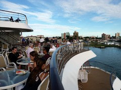
    Here you go, Moonie. I've really enjoyed seeing all of the photos that have been posted.

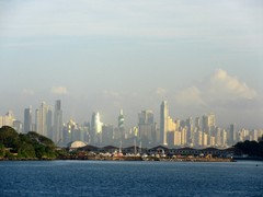
    The narrator who spoke during our passage said that Panama City skyline is among the ten most beautiful in the world. I believe it.


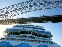
    Before beginning our trip through the canal, we passed under this bridge.


    Our ship followed this cruise ship through the canal.


    Then it was our turn to begin our entry into the canal.


    More to come in post #2.


    moonie_57 (8 NC) thanked Rosie
  • 8 years ago

    Thank you I look forward to your pictures. My half sister went to school there for a few years.

    moonie_57 (8 NC) thanked lovingspring
  • 8 years ago


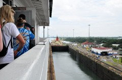
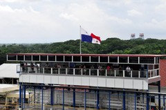
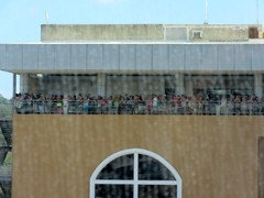
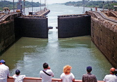
    People watching ships go through the canal from this observation deck.


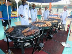
    Panama Canal Crossing Day bbq - any excuse for a party!


    I assume this woman lived here. She was out in her yard waving as boats passed by.


    More to come...

    moonie_57 (8 NC) thanked Rosie
  • 8 years ago

    Summer, I didn't realize how many people have connections to the canal until we took this cruise and I started talking to people about the trip.

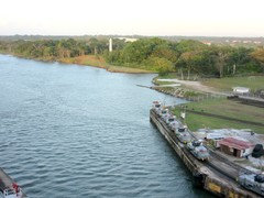
    Gatun Lake.


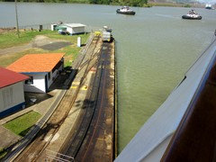
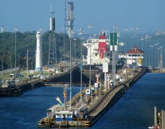
    Locks on Atlantic side if memory serves me correctly.


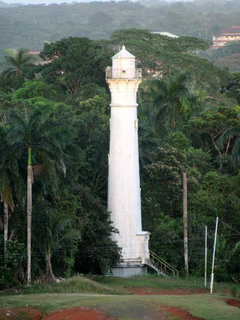
    Moonie, could that be your lighthouse in the distance?


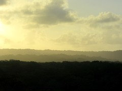
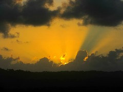
    We started through the canal early in the morning (around 7:00) and finished the journey in the late afternoon / early evening. Not long before we reached the Atlantic Ocean, we were treated to this beautiful sunset.

    Thanks for letting me share those memories and my photos.

    moonie_57 (8 NC) thanked Rosie
  • 8 years ago

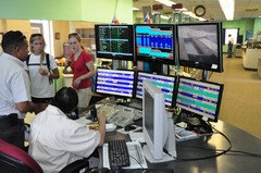
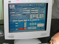
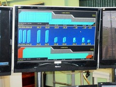
    The large gray control panel was definitely still powered up. I don't recall whether I saw workers use the panel. Mostly they sat in front of the computer displays


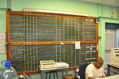
    They also used this large chalkboard grid


    I don't seem to have any pictures of the lighthouse you mention, and I'm not able to see a lighthouse and not take a picture of it.

    In these two photos looking toward the Atlantic from the Control House

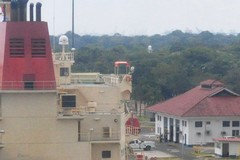
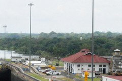
    I zoomed in as much a possible on these two images they might contain the tip of the lighthouse.


    Also from the Control House looking toward the Observation Platform


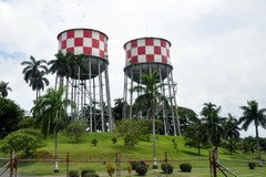
    you can see two red checked water towers in the distance, I got another picture of them as we returned to Colon.


    moonie_57 (8 NC) thanked bob_cville
  • 8 years ago

    Here are a few more pictures taken as we approached Colon on the
    ship, and some snapped as went went to or came back from the locks.


    moonie_57 (8 NC) thanked bob_cville
  • 8 years ago
    last modified: 8 years ago

    Wow, Dawn, thanks! Can't wait to see more! I'll look them over better tomorrow but I wanted to post some photos for Lovingspring.

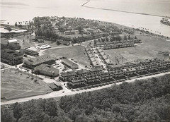
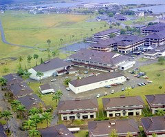
    Lovingspring, here's some photos from Coco Solo. Tlis first one is the main entrance, lower bottom, into Coco Solo. There was a guard shack there, on the left. Just above that little guard shack you see three buildings in a somewhat triangled area? That would be the movie theatre, commissary/barber/grill/tailor, and a hardware store/maintenance store. If your dad was stationed here you can bet he spent a great deal of time in those buildings.

    Here is a closer pic of the movie and commissary buildings. The other larger buildings in the back of the pic are naval barracks. Can't give credit for this photo.. not sure where it came from but appears to be colorized, I'm thinking.

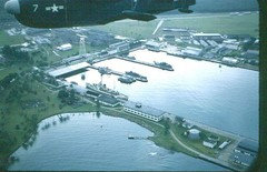
    If your dad were a part of the Seabees, along these piers is where they were stationed. These are submarine piers. To the left side of the piers you can see a light colored roof that appears to go over the water? That is where the Seabees barracks were. A small unit of Seabees were still there as late as 1970, or so.

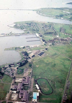
    This pic is from the other end of coco solo. Where you see the track field/football field and the swimming pool, that is the junior/senior high school. The only high school on the Atlantic side for military and American workers so your sister would have gone there if she was of that age. Also in this photo, you can see the submarine piers in the middle of the pic along with some of the naval barracks.

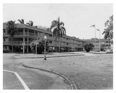
    If your sister was in elementary school, this is where she would have gone. Coco Solo Elementary school.

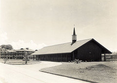
    Next is the non denominational chapel. If your dad and sister attended any kind of religious services, this is the place.

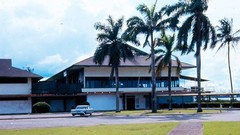
    One more of a place your dad might have spent time at... The Breakers Club. A restaurant/bar that sat right on the bay. Hope these pics might have given you some sense of what he may have done with his time while serving in the CZ.
    Edited to add this one photo of Coco Solo, not my photo. You can still some housing but most of the town of Coco Solo has been torn down. They paved paradise and put up a parking lot!

  • 8 years ago
    last modified: 8 years ago

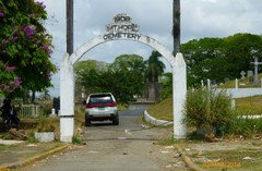
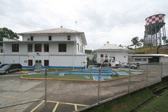
    Thanks, bob! Can't wait to go through more of my pics tomorrow to match yours! If that one photo is Mount Hope cemetary, I have a photo of it, too! Those two checked water towers are at the water treatment plant in Mount Hope. Boy, I'm feeling all warm and fuzzy. :)

  • 8 years ago

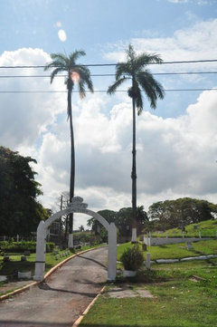
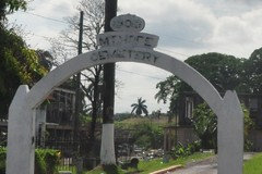
    Yep. Mount Hope Cemetery, 1908

    plus two more of Colon


    moonie_57 (8 NC) thanked bob_cville
  • 8 years ago

    Thank you so very much Moonie!!! As a little girl I had those fanciful dreams of living with my father. Looking at the pictures gives me just a small piece of what his life and maybe mine would have been like. You don't know what it means to me. I have had virtually zero idea until now. If you find more pictures I would like to see them. From any of you wonderful KT folks. Best guess is my sister would have been elementary to middle school age but that is just a guess. Thanks to all of you for the wonderful pictures!!!

    moonie_57 (8 NC) thanked lovingspring
  • 8 years ago

    Really...it is fun to share here.

    moonie_57 (8 NC) thanked jim_1 (Zone 5B)
  • 8 years ago

    I was reading the book Elmer mentioned while on the Semester-at-sea voyage trying to finish before reaching Panama. The book provides incredibly detailed descriptions of the history, the events and the people involved in the initial failed attempt by France to dig the canal and the subsequent attempt by the United States.

    Because it goes into such details the book is quite large, something like 700 pages, such that I didn't manage to finish it before reaching Panama. I have since joked that the author wanted to capture what a truly Herculean task it was to construct the canal by making reading his book nearly as great a feat.

    moonie_57 (8 NC) thanked bob_cville
  • 8 years ago

    Jim, yes, it is fun! Did you see my question regarding the bridge and its location?

    Bob, I've skimmed through the preview a little bit. I was thinking our history classes were taken straight out of that book. :)

    Loving, I'm glad you have enjoyed everyone's photos. When I get home tonight I'll look for any more that you might find interesting.

  • 8 years ago
    last modified: 8 years ago

    Moonie,

    That bridge is at the north end of the canal. Actually beyond the canal, not over it at all. I forget what they will name it when it is completed. They still have a few years to go, although they are moving along at a decent pace.

    For those of you who have not been to the Panama Canal, it does not traverse from east to west, but from North Northwest to South Southeast. So the north end is the Caribbean (Atlantic) side and the south end is the Pacific side. Colon is the nearest city in the north and Panama City is at the south.

    I believe this is call the Millennium Bridge
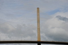
    A closer view of one of the uprights.

    moonie_57 (8 NC) thanked jim_1 (Zone 5B)
  • 8 years ago

    Bob, I have not yet found my photos of Mt. Hope but I talked to a friend and he sent me a few pics. Seems like these were taken a few years after yours. It's a crying shame what has happened to the cemetery and the Panamanian gov's disrespect for it's dead. From what I was told, all US citizens were moved from Mt. Hope to Corozal cemetery on the Pacific side, where the US gov still maintains the cemetery there. Word is, the graves of Atlantic side Panamanians in Mt. Hope that don't have maintenance fees paid, are dug up and the remains thrown into a mass site. Here is a pic of Mt. Hope cemetery from 2014. Note all the trash. Awful!


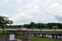
    He also sent this pic of the Mt Hope water treatment plant. There's your checkered water towers.
    If you're interested, here is a link to a lengthy disposition in Washington concerning what was to be done about both Mt. Hope and Corozal cemeteries. In the end, the US gov moved the remains to Corozal and pay to maintain the property and turned Mt. Hope over to Panama. https://archive.org/stream/discem00unit/discem00unit_djvu.txt

    Jim, thanks for the info on the bridge. I'm just thinking, if I were in Gatun and wanted to go to my favorite beach, or to the ski docks, the spillway or to Ft. Sherman, I would have to go all the way towards Colon to cross the bridge and then all the way back towards the locks, probably 20 miles around. Hope they still have the old vehicular bridge up.

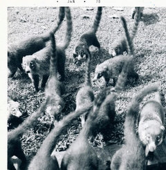
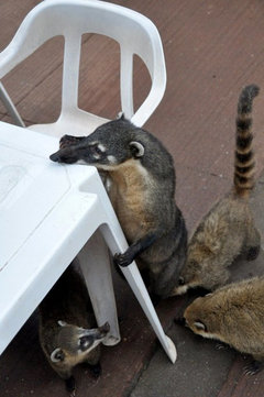
    Loving Spring, I'm searching and searching for photos that I think might have some interest to you and I'm coming up short. Some of the old pics from 60's and early 70's are of poor quality. But, I do have lots of photos that need to be scanned. Unfortunately, most of my pics are of Gatun, because I was older and took a lot of my own pics by then. I'll keep you in mind and promise to look for more of Coco Solo. In the meantime, here's a cute pic of coatimundi's that would come looking for a hand-out all the time. The little buggars were so sweet (as long as you didn't try to pick them up!)

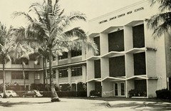
    And another pic of the JR/SR high school where your sister might have gone.

    Dawn, yes! I think it is my lighthouse! I'm waiting for confirmation from a friend!


  • 8 years ago

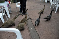
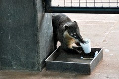
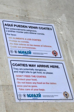
    When we went to Iguassu Falls in Brazil there were coatimundis all around. Especially in the table area near the concession stand.


    There was a sign on each of the tables like this:

    but at the next table a couple sat down, unwrapped a 12" sub sandwich, and then looked away for just a couple of seconds, and a large coati jumped onto the table, grabbed the whole sandwich in its mouth, leaped off the table with it, and ran as fast as possible, with the rest of the troop chasing along behind hoping to grab a share of the sandwich.


    moonie_57 (8 NC) thanked bob_cville
  • 8 years ago

    bob, that's so cool that you got a pic of the coaties! We had one at the house that had half of a foot missing. It was well healed but at some point he disappeared. My mom searched and searched for him and was heart-broken when it became obvious that he was a goner. I have a few pics a friend sent me. I'll share later and compare my lighthouse to Dawn's and the ones from bob. After making inquiries from friends, I have some thank you emails to write.

  • 8 years ago

    I hope it turns out to be your lighthouse, moonie!

    Love the pics of the coatie. That's a funny story about the sandwich being stolen - little opportunists! Reminds me of when we were in Cambodia and saw similar signs about feeding the gibbons.

    moonie_57 (8 NC) thanked Rosie
  • 8 years ago
    last modified: 8 years ago

    Dawn, according to an old schoolmate that still lives in Panama, that is my lighthouse! Being the skeptic that I am, I'm not completely convinced. It's really hard to situate any of the old landmarks with the changing landscape. The last time that I was in Gatun was in 1992 and everything looked pretty much the same. When we went back in 98 everything was different and my husband was not exactly happy to be driving around. It wasn't exactly a fun trip and he swears we won't be going back. There's not a sentimental bone in his body.

    I'm trying to imagine gibbons running lose in the streets. Aren't they rather large? That's kind of scary! :)

    Dawn, bob_cville, Jim_1, do you mind if I save some of your pics? I'll put your names in the file so that I know who they belong to. What do you all think of these photos my friend sent? Can you see the lighthouse sticking up out of the trees? Compare to Dawn's and bob's photos, in your minds, is that the same lighthouse? The only reason I question is because it seemed to me like the lighthouse sat closer to the locks.

    Jim, here's your bridge. Seems like this pic was taken between your two. Between the bridge and the photo with the new expansion, it gives me a better understanding of what it looks like now.

  • 8 years ago

    Moonie I sent you my other email address. Please don't think I am being pushy. No rush!

    moonie_57 (8 NC) thanked lovingspring
  • 8 years ago
    last modified: 8 years ago

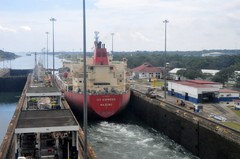
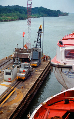
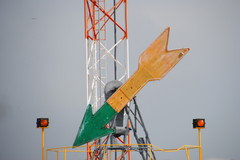
    Here are a few pictures we took while on the Dolphin Oceanbreeze. I think we were about to enter Gatun Lake here . The second picture we are entering Gatun Lake with a good shot of one of the mules. The third pic is my favorite . It shows the arrow which indicated which lane the ship was to take to enter the Atlantic side of the canal. The arrow reminds me of the clocks we made in kindergarten with paper fasteners and a paper plate. Pretty low technology. As I recall, someone physically came out to move the arrow. Should mention this was in 1994, so I assume things might have changed.

    moonie_57 (8 NC) thanked blubird
  • 8 years ago

    Moonie, to my untrained eyes, it does look like the same lighthouse. The location appears to be the same, but in my photo there aren't any trees in front of the lighthouse. In your photo, it is surrounded by trees, so im thinking those trees were removed at some point since you last saw the lighthouse.

    As far as saving the photos, you are welcome to as many of my photos as you want. I'm pleased there are some you like enough to want to save them.


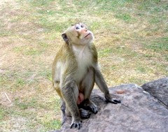
    Not to hijack your thread, but regarding the gibbons, we never saw any in town, but they can be found living around the temple complex of Angkar Wat. They are about the size of a 3 ear old child, but like most monkeys, I imagine they are incredibly strong for their size. Despite the signs, people often fed them for photo ops.

    There are also other species of monkeys thar live around the temples including the long tailed macaque. I took this photo while we were exploring a temple.


  • 8 years ago
    last modified: 8 years ago

    Blubird, they were using the same arrow system when we went through last year. Some things never change!

  • 8 years ago

    Yep, those arrows are there.
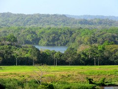
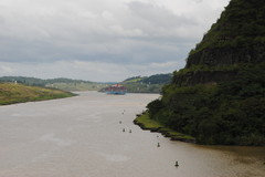
    Going through Gatun Lake

    moonie_57 (8 NC) thanked jim_1 (Zone 5B)
  • 8 years ago

    This has been fun. I'll be going through again this autumn.

    Moonie you can use anything of mine that you want (or need). Those aerial shots are super! Thanks.

    moonie_57 (8 NC) thanked jim_1 (Zone 5B)
  • 8 years ago
    last modified: 8 years ago

    The same goes for any of my pictures. If there are any in particular that you like perhaps for printing out,I'd be willing to put hi-res somewhere for you to download.


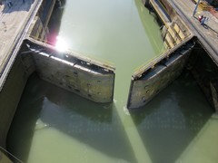
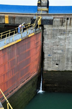
    When we were there in 2011 they said that the the previous December there was a massive rainstorm that caused mudslides down the coast in Portabello, and caused Gatun Lake to rise enough that even having the spillways at the Gatun Dam fully open wasn't enough, and the water was threatening to overtop the dam or flood the canal area or something very bad. So for the first time in the history of the canal they had all of the gates of the canal locks open with water just racing through. We were told that the leak pictured here was caused by damage that occurred when they did that.

    moonie_57 (8 NC) thanked bob_cville
  • 8 years ago

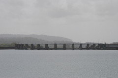
    This is the dam that Bob was referring to. It was cloudy and misty that day.

    moonie_57 (8 NC) thanked jim_1 (Zone 5B)
  • 8 years ago

    I can confirm Elmer's statement that most harbors have dedicated pilots that guide in ships. Certainly any harbor that has the ability to process container or cruise ships - any "mega" ship :-) Here, pilots take over any large ship as it enters Puget Sound, sees to its docking and then guides it out again. It is compulsory.

    moonie_57 (8 NC) thanked gardengal48 (PNW Z8/9)
  • 8 years ago

    Bob, " So for the first time in the history of the canal they had all of the
    gates of the canal locks open with water just racing through".
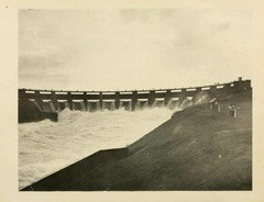
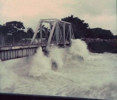
    Wow! Imagine that along with these pics! That must have been quite the sight! All 14 gates of the dam open. We were allowed to be out of school to go and watch whenever all gates were opened.

    Check out the bridge and all the people there to watch.


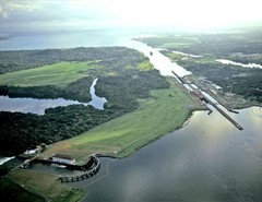
    Someone sent me this photo yesterday. You can see the spillway, the locks, and the new expansion. My house would have sat between the old and new locks. See my lighthouse? :)

  • 8 years ago

    Blubird, Jim... that arrow cracks me up! lol

  • 8 years ago
    last modified: 8 years ago

    I was trying to find video footage of the flooding waters coursing through the open canal gates but haven't had any luck yet.

    I did find two videos of the Semester-at-Sea ship that I traveled on as it passes through the canal.

    First there is a webcam video of it passing through Miraflores Locks:

    and the second is a time-lapse of the ship's entire transit taken by someone on the ship.

    moonie_57 (8 NC) thanked bob_cville
  • 8 years ago

    Bob, thank you! Loved that time lapse video. From the Pacific to the Atlantic in 5 minutes! At the end, you can see my lighthouse off on the right. In the video, the position of the lighthouse looks closer, like I remember. The photos make it look a further distance. Tomorrow I'll watch more videos. Thanks!