


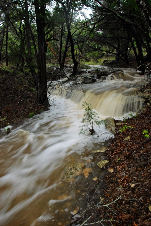
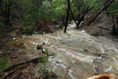
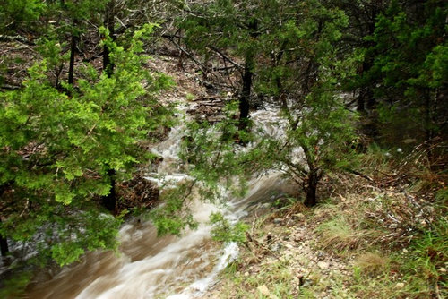
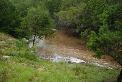
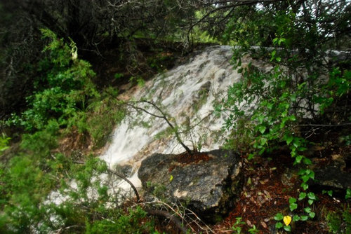
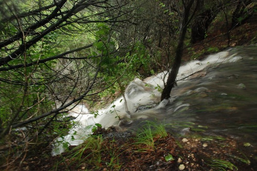
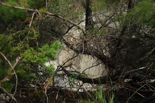
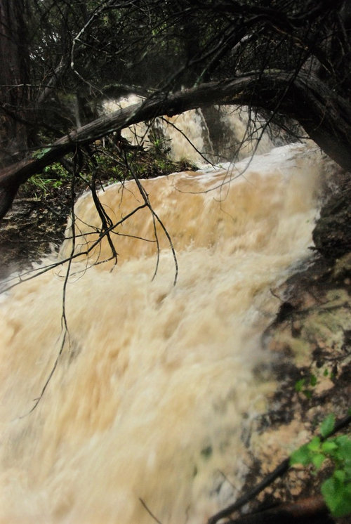
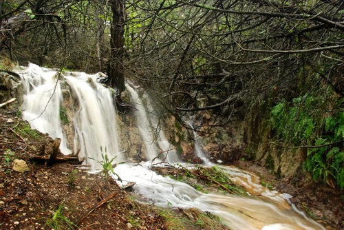
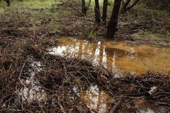
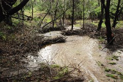
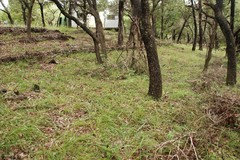
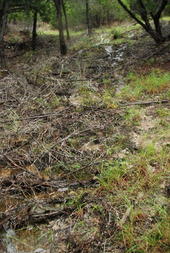
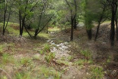
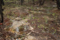
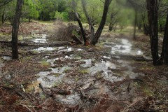
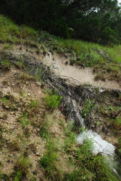
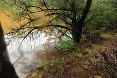
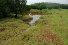
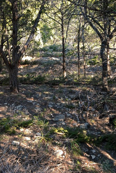
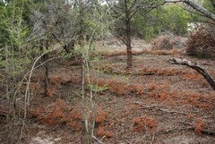
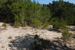
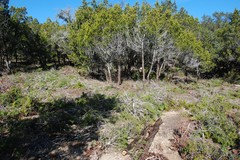
Central Texas storm effects (Pic heavy)
wantonamara Z8 CenTex
8 years ago

Featured Answer
Sort by:Oldest
Comments (21)

wantonamara Z8 CenTex
8 years agolast modified: 8 years agoRelated Discussions
Central Texas - Tree Dying from Top Down
Comments (17)If you scratch off the bark on one of the leafless branches and it is not green then I would remove the tree and plant another one or something else altogether. The spout looking thing next to the trunk is actually an emitter and it would be helpful for you to know how many gallons per hour it releases when it is on. My guess is that the emitter doesn't put out enough water for your tree, especially in the climate that you have. Additionally, with emitters, you have to make sure the area for water output is clear of hardened minerals from the water. If you have even slightly hard water, you will need to replace them every few years. The heads are inexpensive so it's no worries but it could be partially clogged leading to even less water getting to the tree. I know this has already been said but...please also be advised that the people at Lowe's aren't the best to ask complicated plant questions. Forget about asking anyone at Home Depot for sure.... Finally, whoever said about the guy wires being too tight is absolutely correct. You never want to have them that tight. The tree is likely getting strangled....See MoreBrian's Tomato Pics. Pic Heavy 56k beware
Comments (31)Thanks for remembering Brian. They were recovering from the cold nicely and then last week slow down with no weather change. It turns out I made two blunders with them. 1) I planted out too early, March 23, and 2) I didn't give them enough water. Next year, most likely I will plant out around April 7. I only gave them half a gallon of a water a week where before I used to give them 2/3 gallon every 4 days. My water meter told me it was moist. I finally just used my gut feeling and stuck my finger in the dirt which turned out to be dry. So I am now mulching and putting them on 2/3 gallon every 4 day regimen again. Hopefully, I didn't do any permanent damage. Frustrated with myself and seeing your nice 5 gallon buckets, I decided to create my own. I don't have a reciprocating saw so my wife was laughing her butt off at me trying to cut a big hole using small drill and then "connecting the dots" :-(. I found a 3 inch Atrium Grate which turns out to fit the bucket nicely and also stayed put all by itself. It's sturdy and has a place for the top bucket to "rest". Here's a picture and also one of the retaining wall which my wife took. I was too ashamed to take the picture. lol. Tammsf: Nice cages ;-). I am in the same boat as you are. I am inland so nights are colder than Raybo or bdobs....See MoreBuffalo Grass in North Central Texas
Comments (50)Thanks waicklen, well since you asked...why yes, I do! This pic was taken on 6-20-10: 7-2-10, note the huge pile of crabgrass to the left...I pulled this out of the Bermuda and it's only a drop in the bucket! There was virtually no crabgrass in the Turfallo (probably because I put the cardboard and newspaper down in March - just the right time to prevent the seeds from germinating): I wasn't sure how it would respond to mowing so I had the 2nd patch (not the original test area) mowed first on 7-14-10: 7-23-10, original test patch is pretty shaggy looking at about 6-8 inches tall, 2nd patch looks good after mowing: 7-24-10 Baby's first haircut: 7-28-10, couple days after the first mowing, grass is brownish, all the green tips were cut off, I was worried... ...but it turned green again pretty quickly as you can see in the background of this pic taken on 8-12-10: I am very happy with it, it has weathered this heatwave well with very little attention, I think I watered it maybe 3 times this summer and I probably could have avoided mowing completely if I wanted to....See MoreHeads up - widespread heavy rainfall in Texas
Comments (22)Received 3" of rain in NW Austin. I was sad to see the majority of the front move east, but 3" is nice to get. I have a creek bed at the edge of my property and it wasn't as swollen as I would have expected considering how heavy the rain fell at times. There is a 30-40% chance of rain again next weekend for us, so here's to more rain! If we don't get a bunch soon, Austin will likely go into stage 3 water restrictions. I believe if Lake Travis drops below 615 feet (we're at 619.5 now), that triggers stage 3....See More
s8us89ds
8 years ago
loreleicomal
8 years ago
PKponder TX Z7B
8 years agolisanti07028
8 years agos8us89ds
8 years agowantonamara Z8 CenTex
8 years agolast modified: 8 years ago
roselee z8b S.W. Texas
8 years agowantonamara Z8 CenTex
8 years agoTxMarti
8 years agowantonamara Z8 CenTex
8 years agowantonamara Z8 CenTex
8 years ago
jardineratx
8 years ago
Nettie
8 years agowantonamara Z8 CenTex
8 years agoroselee z8b S.W. Texas
8 years agos8us89ds
8 years agolast modified: 8 years agoloreleicomal
8 years agos8us89ds
8 years agolast modified: 8 years agowantonamara Z8 CenTex
8 years ago
Related Stories
GARDENING GUIDESGardening Solutions for Heavy Clay Soils
What’s a gardener to do with soil that’s easily compacted and has poor drainage? Find out here
Full Story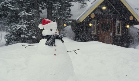
LIFEShare Your Winter Storm Jonas Photos and Survival Tips!
Let’s see your pictures and hear your ideas on how you’re keeping your house warm and staving off cabin fever
Full Story
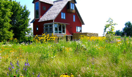
HOUZZ TOURSHouzz Tour: Unplugging From High Tech in a Texas Farmhouse
This simply styled home gives an Austin family all the warmth of comfort food and all the amenities of modern times
Full Story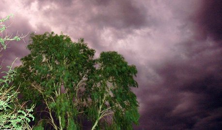
GARDENING GUIDESHow to Get Your Landscape Ready for Summer Storms
Don’t let high winds, dust storms and torrential rainfall catch you or your landscape by surprise
Full Story
WINTER GARDENINGHow to Help Your Trees Weather a Storm
Seeing trees safely through winter storms means choosing the right species, siting them carefully and paying attention during the tempests
Full Story
LIFEPolar Vortex: How Houzzers Are Coping With the Storm
Spirits are staying high even as the mercury plunges to new lows. Do any of these firsthand accounts sound familiar?
Full Story
KITCHEN OF THE WEEKKitchen of the Week: The Calm After the Storm
Ravaged by Hurricane Sandy, a suburban New York kitchen is reborn as a light-filled space with a serene, soothing palette
Full Story
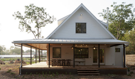
HOUZZ TOURSHouzz Tour: A New Texas Farmhouse Pulls a Neat Trick
Fresh from the drawing board, this home for organic farmers in Austin looks remodeled and expanded over time
Full Story
FARMHOUSESHouzz Tour: German Tradition Deep in the Heart of Texas
Rooted in architecture from the 1800s, this award-winning home mixes history with the vernacular of today
Full StorySponsored
wantonamara Z8 CenTexOriginal Author