


Hurricane Earl--Going to be an 'interesting' week!
User
13 years ago
Sort by:Oldest
Comments (44)
Related Stories
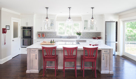
KITCHEN OF THE WEEKKitchen of the Week: The Calm After the Storm
Ravaged by Hurricane Sandy, a suburban New York kitchen is reborn as a light-filled space with a serene, soothing palette
Full Story
ARCHITECTURE4 Things a Hurricane Teaches You About Good Design
When the power goes out, a home's design can be as important as packaged food and a hand-crank radio. See how from a firsthand account
Full Story
DISASTER PREP & RECOVERYHouzz Tour: Family Rebuilds Home and Community After Hurricane Sandy
This restored coastal New Jersey house — now raised 9 feet off the ground — offers inspiration for neighbors considering a return
Full Story
MOST POPULARWhat to Do After a Hurricane or Flood
How you treat your home after a natural disaster can make all the difference in its future livability — and your own personal safety
Full Story
DISASTER PREP & RECOVERYHouzz Tour: Modern Farmhouse Emerges From Hurricane Sandy Devastation
A homeowner loses her cottage but gains a new energy-efficient, low-maintenance home
Full Story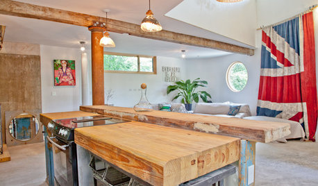
LIFEYou Said It: ‘Yikes, Tough Crowd’ and Other Quotes of the Week
Some of our favorite quotes this week came straight from the Comments section. See the stories and have your own say
Full Story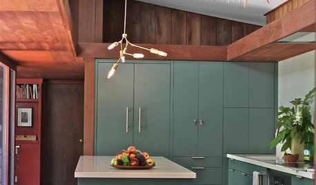
KITCHEN DESIGNKitchen of the Week: Modern Update for a Midcentury Gem
A kitchen remodel keeps the original redwood paneling and concrete floors but improves functionality and style
Full Story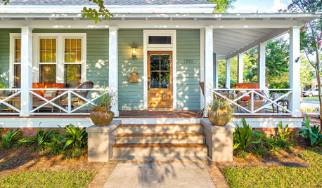
PORCH OF THE WEEKA Wraparound Goes From Unwelcoming to Irresistible
Renovating the porch adds neighborliness and charm to this 1908 Florida home
Full Story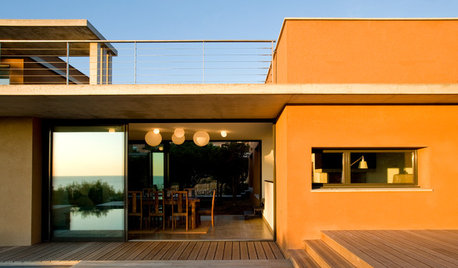
COLORExterior Color of the Week: 5 Ways to Make Orange Work for You
Whether you opt for a little or a lot, bold orange will bring drama to your home
Full Story
DECORATING GUIDESEdit Keepsakes With Confidence — What to Let Go and What to Keep
If mementos are weighing you down more than bringing you joy, here's how to lighten your load with no regrets
Full Story
tropicalzone7
Loveplants2 8b Virginia Beach, Virginia
Related Discussions
Hurricane Season and the Balcony - Here we go again!
Q
in prep of hurricane?
Q
Hurricane Earl....yikes....
Q
'Vase filler' type stuff for hurricane style candle holders?
Q
UserOriginal Author
tropicalzone7
UserOriginal Author
tropicalzone7
brooklyngreg
tropicalzone7
tropicalzone7
tropicalzone7
Loveplants2 8b Virginia Beach, Virginia
NoVaPlantGuy_Z7b_8a
UserOriginal Author
jimhardy
NoVaPlantGuy_Z7b_8a
tropicalzone7
UserOriginal Author
Loveplants2 8b Virginia Beach, Virginia
brooklyngreg
tropicalzone7
jimhardy
UserOriginal Author
jimhardy
UserOriginal Author
tropicalzone7
NoVaPlantGuy_Z7b_8a
tropicalzone7
UserOriginal Author
brooklyngreg
tropicalzone7
tropicalzone7
NoVaPlantGuy_Z7b_8a
Loveplants2 8b Virginia Beach, Virginia
jimhardy
tropicalzone7
NoVaPlantGuy_Z7b_8a
tropicalzone7
NoVaPlantGuy_Z7b_8a
Loveplants2 8b Virginia Beach, Virginia
NoVaPlantGuy_Z7b_8a
UserOriginal Author
tropicalzone7
UserOriginal Author
tropicalzone7