


'Extremely Critical' Fire Weather Thursday
Okiedawn OK Zone 7
15 years ago
Sort by:Oldest
Comment (1)
Related Stories
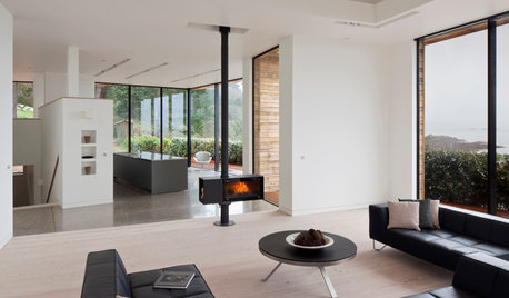
FIREPLACESUpdated Woodstoves Keep Home Fires Burning
Better technology means more efficiency than ever for modern woodstoves
Full Story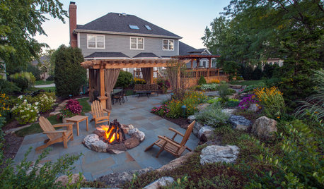
GARDENING AND LANDSCAPING3 Ways to Bring the Heat to Outdoor Living Spaces
Here’s what to know about surviving winter’s bite with an outdoor fireplace, fire pit or heat lamp
Full Story
FIREPLACESDesign Workshop: Smart Ways to Store Wood Outdoors
Consider size, location, protection, air circulation and, of course, style for storing your firewood
Full Story
DESIGNER SHOWCASESEscape to a Summer Holiday Fantasy at a Hamptons Show House
Imaginative designs meet philanthropy in a sprawling New York home, in rooms meant to inspire — if not actually live in
Full Story
MOST POPULARHow to Create an Inventory, Whether You're Naturally Organized or Not
Documenting your home items is essential, even if disaster seems unimaginable. And it may be easier than you think
Full Story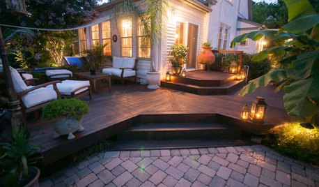
MOST POPULARWhat to Know About Adding a Deck
Want to increase your living space outside? Learn the requirements, costs and other considerations for building a deck
Full Story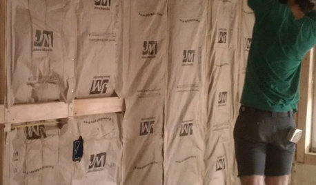
REMODELING GUIDESCool Your House (and Costs) With the Right Insulation
Insulation offers one of the best paybacks on your investment in your house. Here are some types to discuss with your contractor
Full Story
MODERN ARCHITECTUREKeep Your Big Windows — and Save Birds Too
Reduce bird strikes on windows with everything from architectural solutions to a new high-tech glass from Germany
Full Story
DREAM SPACESHouzz Tour: Hugging the Rocky Cliffs in Big Sur
Cascading down a rugged site and generously encased in glass, this California home takes full advantage of its ocean views
Full Story
ARCHITECTURE4 Things a Hurricane Teaches You About Good Design
When the power goes out, a home's design can be as important as packaged food and a hand-crank radio. See how from a firsthand account
Full Story
Okiedawn OK Zone 7Original Author
Related Discussions
Fire and Rain on Thursday
Q
Wed.: Fire Warning/Fire Weather Watch That Includes OKC
Q
Thurs: Fire Weather Watch for Most of W OK
Q
Red Flag Fire Warning Thursday for SW OK
Q