


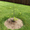
Hurricane Sandy, is she visiting anyone here?
ilovemytrees
11 years ago
Sort by:Oldest
Comments (57)
Related Stories
DISASTER PREP & RECOVERYHouzz Tour: Modern Farmhouse Emerges From Hurricane Sandy Devastation
A homeowner loses her cottage but gains a new energy-efficient, low-maintenance home
Full Story
DISASTER PREP & RECOVERYHouzz Tour: Family Rebuilds Home and Community After Hurricane Sandy
This restored coastal New Jersey house — now raised 9 feet off the ground — offers inspiration for neighbors considering a return
Full Story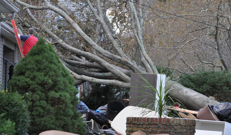
DISASTER PREP & RECOVERY7 Ways to Help Someone Hit by a Hurricane
The best things you can do in the wake of devastation are sometimes the most surprising
Full Story
COASTAL STYLEBungalow Kitchen Finds a New Life After Hurricane Sandy
A storm surge destroyed a couple’s previous home, but that didn’t stop them from embracing the sea with a new nautical-style kitchen
Full Story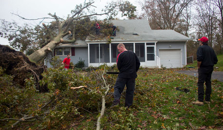
MOST POPULARWhat to Do After a Hurricane or Flood
How you treat your home after a natural disaster can make all the difference in its future livability — and your own personal safety
Full Story
HOUZZ TOURSHouzz Tour: Ready for Hurricane Season on the Jersey Shore
This family home was designed to stand up to storms. See how the architects built resilience into the design
Full Story
BEDROOMSThe Cure for Houzz Envy: Master Bedroom Touches Anyone Can Do
Make your bedroom a serene dream with easy moves that won’t give your bank account nightmares
Full Story
ARTHere’s Looking at You: Supersize Portraiture at Home
Go big. Go bold. Hang huge portraits on blank walls for maximum impact
Full Story
DECORATING GUIDESThe Cure for Houzz Envy: Guest Room Touches Anyone Can Do
Make overnight guests feel comfy and cozy with small, inexpensive niceties
Full Story
BUDGET DECORATINGThe Cure for Houzz Envy: Living Room Touches Anyone Can Do
Spiff up your living room with very little effort or expense, using ideas borrowed from covetable ones
Full Story


ilovemytreesOriginal Author
famartin
Related Discussions
Hurricane Sandy, damaged lawn tractors
Q
Hurricane Sandy--Stay Safe Forum Friends
Q
Hurricane Sandy - discount on cork flooring!
Q
Another Victim of Hurricane Sandy
Q
ilovemytreesOriginal Author
User
famartin
Dzitmoidonc
User
Dzitmoidonc
User
ilovemytreesOriginal Author
bengz6westmd
bengz6westmd
Dzitmoidonc
pineresin
wisconsitom
User
franktank232
bengz6westmd
lisanti07028
ilovemytreesOriginal Author
famartin
shesabstrakt
poaky1
famartin
wisconsitom
pineresin
ilovemytreesOriginal Author
User
poaky1
ilovemytreesOriginal Author
jimbobfeeny
wisconsitom
bengz6westmd
jimbobfeeny
whaas_5a
ilovemytreesOriginal Author
User
famartin
Dzitmoidonc
c2g
bengz6westmd
arktrees
User
arktrees
famartin
famartin
famartin
terrene
wisconsitom
lisanti07028