


RCVF etc.
Went south this weekend.
Spanish Peaks (West: 13,626'/4153m; East: 12,860'/3920 m).
Volcanic mountains along the Culebra Range (subrange of Sangre de Cristo Mountains, which is subrange of Rocky Mountains).
{{gwi:630650}}
Evening light on Fisher's Peak, near Trinidad. Primarily Pinus edulis, Juniperus monosperma, and Pinus ponderosa.
{{gwi:630651}}
Friday night sunset on the Sangre de Cristo. Pinus Edulis.
{{gwi:630652}}
Sunset
{{gwi:630653}}
Saturday morning, Sangre de Cristo.
{{gwi:630654}}
Sugarite Park (south of the Colorado - New Mexico border)
Pinus ponderosa, Juniperus, Abies concolor, and Pseudotsuga menziesii.
{{gwi:630655}}
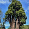
Pinus ponderosa (subspecies brachyptera?)
The one on the right had twisted needles
{{gwi:592591}}
{{gwi:592592}}
Capulin Volcano National Monument
You can drive up, and hike around the rim and into the crater
{{gwi:630662}}
Driving up the volcano road. No guardrail!
At first glance I thought the park service had spread sand on the road to improve winter traction.
{{gwi:630664}}
A closer inspection revealed it was crushed volcanic rock!
Very similar to the scoria I've used when potting up conifers. Hmm.
{{gwi:630666}}
Looking down into the crater
Pinus edulis, Juniperus monosperma, Quercus gambelii
{{gwi:630668}}
Quercus gambelii
{{gwi:630669}}
Mule deer (Odocoileus hemionus) inside of the crater.
{{gwi:630670}}
Hiking along the volcano rim and enjoying the view.
Pinus edulis and Juniperus monosperma. A very occasional Pinus ponderosa.
{{gwi:630671}}
Pinus edulis conelet
{{gwi:630672}}
Juniperus monosperma with twisted trunk. P. edulis on right.
{{gwi:630673}}
Juniperus monosperma foliage.
{{gwi:630674}}
The windswept ridge along the volcano rim was home to many interesting Pinus edulis forms.
{{gwi:630675}}
Pinus edulis.
You can also see the Baby Capulin cinder cone and Mud Hill boca.
{{gwi:630676}}
According to the interpretive sign, Baby Capulin (right) was the last known eruption of the Capulin Phase.
The Mud Hill tuff ring is just to the left of Baby Capulin, and was formed by the explosive contact between hot magma and groundwater.
{{gwi:630677}}
Pinus edulis.
{{gwi:630678}}
View from the rim, looking toward the Sangre de Cristo range.
{{gwi:630680}}
Pinus edulis
{{gwi:630682}}
According to the interpretive sign, as the volcanos erupted, lava flowed into the lower lying areas where it cooled and hardened.
Later, the surrounding sedimentary rock eroded away, and the lava remained as flat-topped highlands called mesas.
The Sangre de Cristo range in the background is the southernmost range of the Rocky Mountains, extending down to Santa Fe, New Mexico.
{{gwi:630684}}
Here you can see pressure ridges at the base of the volcano.
According to the interpretive sign, these ripply lava formations are caused by hot lava moving the surface that had already cooled and hardened to a crust.
It looks like the pressure ridges also provide favorable conditions for the Pinus edulis and Juniperus monosperma.
{{gwi:630686}}
Lava pressure ridges.
{{gwi:630688}}
Windswept Pinus edulis.
{{gwi:630690}}
Pinus edulis dwarf.
{{gwi:613481}}
Raton-Clayton Volcanic field, interpretive sign.
{{gwi:630692}}
On our way back to Colorado, we spotted a Pinus ponderosa broom.
{{gwi:592590}}
Exploring the back roads. Here is an abandoned farm.
Pinus edulis, Juniperus monosperma.
{{gwi:630695}}
Juniperus monosperma.
{{gwi:592595}}
Pinus edulis. A nice lemon-lime color.
{{gwi:592589}}
Retaining wall, with automotive theme.
{{gwi:630700}}
Could be a nice rock garden motif.
{{gwi:630702}}
{{gwi:630704}}
Moon over grassland sunset. Pinus edulis and Juniperus monosperma.
{{gwi:630705}}

coniferjoy
Toronado3800 Zone 6 St Louis
tunilla
Snowden_Yesteryear
taxo_man
kmanzfive laknee
greenman28 NorCal 7b/8a
noki
botann
severnside
gardener365
sluiceOriginal Author
bluespruce53
bunkers